Digital Integration and Smart Infrastructure
As cities embrace digital transformation, utility mapping is becoming a key component of smart infrastructure planning. Integrating GPR survey data into digital platforms helps create more accessible, real-time infrastructure management systems.
- GIS Integration: Subsurface utility data can be mapped and stored in geographic information systems for better coordination across construction, maintenance, and planning teams.
- Mobile and Software Solutions: GPR-collected data can be used to develop applications that deliver utility maps and alerts in real-time, enhancing safety and reducing delays in fieldwork.
- Smart City Planning: Accurate utility mapping is critical to avoid accidental damage during infrastructure upgrades and ensures smarter, more sustainable urban development.
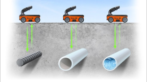
Test Procedure for GPR Utility Surveys
-
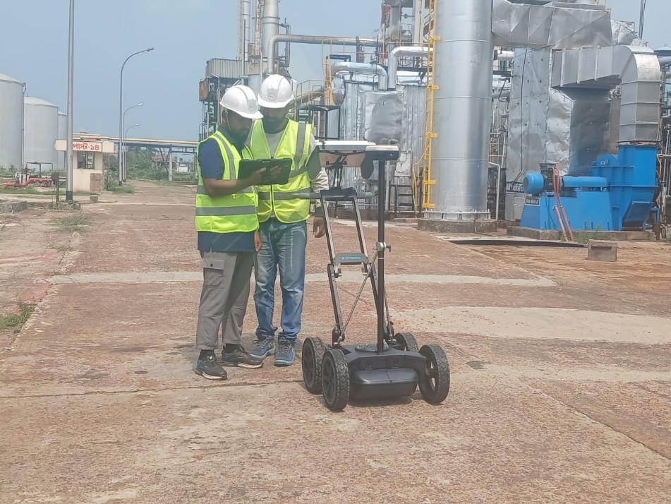
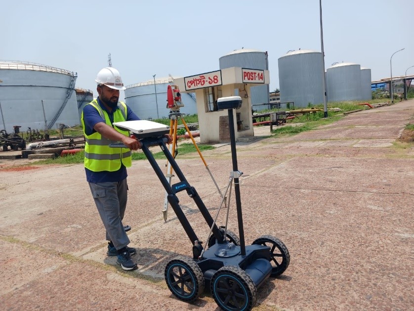
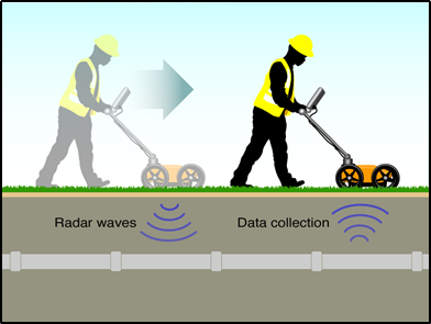
- Preparation: Survey site is assessed and GPR equipment is calibrated based on local soil conditions and target utility
- Survey Execution: The GPR unit—often mounted on a cart—is rolled over the area, emitting radar pulses and recording reflections.
- Data Collection: Subsurface reflections are captured by the system and stored for processing.
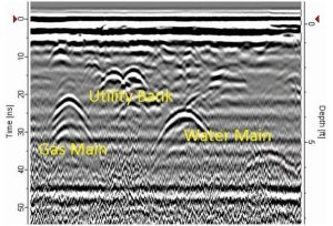
 Analysis:
Specialists analyze the radar data to identify utilities, voids, or other subsurface features.
- Reporting: Final reports include maps and diagrams showing the
location, depth, and condition of utilities, along with any anomalies or recommended actions.
 Key Benefits of Using GPR in Utility Surveys
- Non-Invasive: No need for excavation, minimizing surface disruption.
- Real-Time Feedback: Instant results help decision-makers act quickly and efficiently.
- High Accuracy: Pinpoints utility location, depth, and orientation with precision.
- Cost-Effective: Reduces costs related to manual digging and utility damage.
- Multi-Utility Detection: Identifies water, gas, electricity, telecom, and other underground systems in a single survey.
 Ground Penetrating Radar has revolutionized the field of utility surveying, offering a reliable, non-invasive, and highly accurate way to map the subsurface utility detection. As the need for efficient infrastructure management grows, the adoption of GPR will continue to expand globally. From improving construction safety to enabling smart city development, GPR stands as a critical tool for modern utility management and digital transformation.