About Us
Services
Civil Engineering Testing Services
Condition Monitoring Services
Consultancy
Projects
Upcoming Projects
Ongoing Projects
Completed Projects
Support
Repairs, Parts & Rentals
Installation & Commissioning
Calibration & Verification
Training
Industries
Power & Energy
Education
Disaster Management
Road & Transportation
Geometrical Properties
Resources
Blog
Ongoing Projects
Completed Projects
Contact Us
Portfolio
Aggregates
Aggregates
Geometrical Properties
Assessment of Fines
Determination of Particle Shape
Sample Splitters
Mechanical and Physical Properties
Chemical Properties
Determination of Density and Water Absorption
Moisture Measurement
Resistance to Fragmentation, Abrasion and Wear
Thermal Properties
Sample Grading
Sieve Shakers
Sieves & Screen Trays
Aggregate Crushing Value (ACV) Device
Rock Testing
Aggregate Crushing Value (ACV) Test
Hoek Cells for Triaxial Rock Testing in Bangladesh
Aggregate Impact Value (AIV) Test in Bangladesh
Scratch Hardness Tester For Rock Scratch Hardness Testing Equipment in Bangladesh
Mohs Scale of Hardness
Point Load Tester
Bitumen & Asphalt
Bitumen & Asphalt
Asphalt Mix Composition Analysis
Automatic Binder Extraction Systems
Binder and Solvent Recovery
Manual Binder Extraction Systems - Cold Method
Manual Binder Extraction Systems - Hot Method
Other Asphalt Mix Properties
Asphalt Mix Sample Preparation
Asphalt Compactors (Roller and PreSBox Compactors)
Asphalt Mixers
Cutting and Coring Machines
Dynamic Asphalt Mix Testing Systems
AMPT - Asphalt Mixture Performance Tester
AsphaltQube - Modular EmS Dynamic Asphalt Testers
Dynamic Testing Accessories
Stand-Alone Asphalt Testers
Universal Testing Machines UTM
Gyratory Compaction & Wheel Tracking
Gyratory Compactors
Wheel Tracking Machines
Marshall Stability, BMD and Indirect Tensile
Balanced Mix Design
Marshall Water Baths
Marshall and other Compactors
Marshall, Indirect Tensile and BMD Testers
Other Asphalt Mix Tests
Road Quality Testing
Indentation
Permeameters
Polishing Tests
Slurry Seal Testing
Surface Properties
Building Materials
Building Materials
Cement Testing
Sampling
Soundness
Fineness
Air Content
Measurement of length changes
Potential Alkali Reactivity, Expansion Test
Heat of Hydration
Water Retention
Bulk Density
Carbon Dioxide Content
Building Lime Testing
Grout Testing
Mud Testing
Standard sand
Concrete Testing
Preparation of Specimens - Mixing
Air Entrainment-Mortar
Workability and Consistency of Fresh Concrete
Density of Fresh Concrete
SCC Testing Apparatus
Gyratory Compactors for Cement and Concrete
Heat of Hydration Fresh Concrete
Determination of Strength
Compression Strength Test
Bond Strength Test
Flexural Beam Testing
Hardened Concrete Testing
Concrete Compaction
Concrete Specimen Molds
Curing Tanks
Cylinder Capping
Coring, cutting and grinding machines
Density of Hardened Concrete
Water Penetration
Creep Testing
Shotcrete Strength and Special Testing
Control Consoles for Advanced Testing
MoE Accessories and Compressometers
Testing Fiber Reinforced Concrete and Shotcrete
Concrete Pipe Testing Machines
NDT Testing
NDT Testing
Mechanical NDT Testing
Steel Structure NDT
Mechanical maintenance NDT
Civil NDT Testing
Structural NDT Testing
Concrete NDT Testing
Foundation & Pile Testing
Pavement & Road NDT
General Lab
General Lab
Basic Laboratory Instruments
Heating & Drying Equipment
Refrigeration & Storage Equipment
Sterilization Equipment
Laboratory Incubation Equipment
Sample Preparation Equipment
Spectroscopy Instruments
Chromatography Instruments
Core Drilling
Thermal Analysis Instruments
Sample Drying
Molecular Biology Equipment
General Laboratory Apparatus
Laboratory Measurement Instruments
Measuring Instruments
Laboratory Safety Equipment
Weighing Samples
Laboratory Consumables
Geoscience
Geoscience
Geology
Geophysics
Geochemistry
Hydrology
geodynamics
Earthquake Testing
Petrochemical Testing
Petrochemical Testing
Lubricant Testing Laboratory
Transformer Oil Testing Laboratory
Coal & Coke Testing Laboratory
LPG & Natural Gas Testing Laboratory
Petrochemical Raw Materials Testing Laboratory
Polymer Testing Laboratory
Plastic Raw Material Testing Laboratory
Rubber Testing Laboratory
Fuel Quality Testing Laboratory
Biofuel Testing Laboratory
Environmental Petrochemical Testing Laboratory
Corrosion Testing Laboratory
Rock Testing Equipment
Uniaxial and Triaxial Testing on Rocks
Crude Oil Testing Laboratory
Petroleum Products Testing Laboratory
Soil
Soil
Soil-Field
Augers & Auger Sets
CBR Field Test
Compaction-Density
Compaction-Stiffness
Earth Drill
Powered
Field Charts
Hydraulic Conductivity and Infiltration
Penetrometers
Plate Load Test
Probe Rods
Resistivity
Shear Vane
Torvane
Soil Moisture Tester
Soil Sampling
Water Evaluations
Soil-Lab
Atterberg Limits
Calcium Carbonate Content
CBR Load Frames
Color
Consolidometers
Expansion Index Testing
Hydrometer Analysis of Soil
Moisture Content of Soil
Permeability of Soil
pH
Pin Hole Dispersion
Relative Density of Soil
Soil Compaction Tests
Soil Sample Ejectors
Sand Equivalent Test
Sample Preparation
Unconfined Soil Tester
Volume Change of Soil
Soil Mechanics
Consolidation Testing Machines
Direct Shear Testing Machines
Triaxial Testing Equipment
Data Loggers
S-Type Load Cells in Bangladesh
Linear Variable Displacement Transducers (LVDT)
Proving Rings for Calibration
Dial Indicators
Erosion Function Apparatus
Material Testing
Material Testing
Metal Testing Laboratory
Polymer & Plastic Testing Laboratory
Composite Materials Testing Laboratory
Ceramic & Glass Testing Laboratory
Textile & Fabric Testing Laboratory
Paper & Packaging Testing Laboratory
Wood & Timber Testing Laboratory
Paint, Coating & Surface Testing Laboratory
Adhesive & Sealant Testing Laboratory
Foam & Insulation Testing Laboratory
Electrical Insulation Materials Testing Laboratory
Advanced Nanomaterials Testing Laboratory
Failure Analysis & Fractography Laboratory
Electromechanical Universal Tester
Steel and Rebars Testing
Monitoring
Monitoring
Data Acquisition and Monitoring Laboratory
Multi-channel DAQ systems
Data Loggers
Sensor and Instrumentation Laboratory
Structural Dynamics and Vibration Laboratory
Environmental
Environmental
Water Quality Testing Laboratory
pH Meter
Conductivity Testing
Turbidity Testing
Dissolved Oxygen (DO)
Biological Oxygen Demand (BOD)
Chemical Oxygen Demand (COD)
Total Suspended Solids (TSS) Testing
Total Dissolved Solids (TDS)
Heavy Metal Analysis
Nutrient Analysis
Wastewater Testing Laboratory
Industrial Effluent Analysis
Air Quality Monitoring Laboratory
Stack Emission Testing
Microbiology Laboratory
General Microbiology Lab
Bacteriology Lab
Mycology Lab
Virology Lab
Parasitology Lab
Immunology Lab
Molecular Microbiology Lab
Microbial Genetics Lab
Industrial Microbiology Lab
Agricultural Microbiology Lab
Clinical Microbiology Lab
Environmental Chemistry Laboratory
Trace Metal Analysis
Noise & Vibration Monitoring Laboratory
Environmental Monitoring & Field Testing Unit Groundwater Monitoring
Shop by Category
Aggregates
Bitumen & Asphalt
Building Materials
NDT Testing
General Lab
Geoscience
Petrochemical Testing
Soil
Material Testing
Monitoring
Environmental
About Us
Services
Projects
Support
Industries
Resources
Contact Us
About Us
Services
Civil Engineering Testing Services
Condition Monitoring Services
Consultancy
Projects
Upcoming Projects
Ongoing Projects
Completed Projects
Support
Repairs, Parts & Rentals
Installation & Commissioning
Calibration & Verification
Training
Industries
Power & Energy
Education
Disaster Management
Road & Transportation
Geometrical Properties
Resources
Blog
Ongoing Projects
Completed Projects
Contact Us
Portfolio
Aggregates
Aggregates
Geometrical Properties
Assessment of Fines
Determination of Particle Shape
Sample Splitters
Mechanical and Physical Properties
Chemical Properties
Determination of Density and Water Absorption
Moisture Measurement
Resistance to Fragmentation, Abrasion and Wear
Thermal Properties
Sample Grading
Sieve Shakers
Sieves & Screen Trays
Aggregate Crushing Value (ACV) Device
Rock Testing
Aggregate Crushing Value (ACV) Test
Hoek Cells for Triaxial Rock Testing in Bangladesh
Aggregate Impact Value (AIV) Test in Bangladesh
Scratch Hardness Tester For Rock Scratch Hardness Testing Equipment in Bangladesh
Mohs Scale of Hardness
Point Load Tester
Bitumen & Asphalt
Bitumen & Asphalt
Asphalt Mix Composition Analysis
Automatic Binder Extraction Systems
Binder and Solvent Recovery
Manual Binder Extraction Systems - Cold Method
Manual Binder Extraction Systems - Hot Method
Other Asphalt Mix Properties
Asphalt Mix Sample Preparation
Asphalt Compactors (Roller and PreSBox Compactors)
Asphalt Mixers
Cutting and Coring Machines
Dynamic Asphalt Mix Testing Systems
AMPT - Asphalt Mixture Performance Tester
AsphaltQube - Modular EmS Dynamic Asphalt Testers
Dynamic Testing Accessories
Stand-Alone Asphalt Testers
Universal Testing Machines UTM
Gyratory Compaction & Wheel Tracking
Gyratory Compactors
Wheel Tracking Machines
Marshall Stability, BMD and Indirect Tensile
Balanced Mix Design
Marshall Water Baths
Marshall and other Compactors
Marshall, Indirect Tensile and BMD Testers
Other Asphalt Mix Tests
Road Quality Testing
Indentation
Permeameters
Polishing Tests
Slurry Seal Testing
Surface Properties
Building Materials
Building Materials
Cement Testing
Sampling
Soundness
Fineness
Air Content
Measurement of length changes
Potential Alkali Reactivity, Expansion Test
Heat of Hydration
Water Retention
Bulk Density
Carbon Dioxide Content
Building Lime Testing
Grout Testing
Mud Testing
Standard sand
Concrete Testing
Preparation of Specimens - Mixing
Air Entrainment-Mortar
Workability and Consistency of Fresh Concrete
Density of Fresh Concrete
SCC Testing Apparatus
Gyratory Compactors for Cement and Concrete
Heat of Hydration Fresh Concrete
Determination of Strength
Compression Strength Test
Bond Strength Test
Flexural Beam Testing
Hardened Concrete Testing
Concrete Compaction
Concrete Specimen Molds
Curing Tanks
Cylinder Capping
Coring, cutting and grinding machines
Density of Hardened Concrete
Water Penetration
Creep Testing
Shotcrete Strength and Special Testing
Control Consoles for Advanced Testing
MoE Accessories and Compressometers
Testing Fiber Reinforced Concrete and Shotcrete
Concrete Pipe Testing Machines
NDT Testing
NDT Testing
Mechanical NDT Testing
Steel Structure NDT
Mechanical maintenance NDT
Civil NDT Testing
Structural NDT Testing
Concrete NDT Testing
Foundation & Pile Testing
Pavement & Road NDT
General Lab
General Lab
Basic Laboratory Instruments
Heating & Drying Equipment
Refrigeration & Storage Equipment
Sterilization Equipment
Laboratory Incubation Equipment
Sample Preparation Equipment
Spectroscopy Instruments
Chromatography Instruments
Core Drilling
Thermal Analysis Instruments
Sample Drying
Molecular Biology Equipment
General Laboratory Apparatus
Laboratory Measurement Instruments
Measuring Instruments
Laboratory Safety Equipment
Weighing Samples
Laboratory Consumables
Geoscience
Geoscience
Geology
Geophysics
Geochemistry
Hydrology
geodynamics
Earthquake Testing
Petrochemical Testing
Petrochemical Testing
Lubricant Testing Laboratory
Transformer Oil Testing Laboratory
Coal & Coke Testing Laboratory
LPG & Natural Gas Testing Laboratory
Petrochemical Raw Materials Testing Laboratory
Polymer Testing Laboratory
Plastic Raw Material Testing Laboratory
Rubber Testing Laboratory
Fuel Quality Testing Laboratory
Biofuel Testing Laboratory
Environmental Petrochemical Testing Laboratory
Corrosion Testing Laboratory
Rock Testing Equipment
Uniaxial and Triaxial Testing on Rocks
Crude Oil Testing Laboratory
Petroleum Products Testing Laboratory
Soil
Soil
Soil-Field
Augers & Auger Sets
CBR Field Test
Compaction-Density
Compaction-Stiffness
Earth Drill
Powered
Field Charts
Hydraulic Conductivity and Infiltration
Penetrometers
Plate Load Test
Probe Rods
Resistivity
Shear Vane
Torvane
Soil Moisture Tester
Soil Sampling
Water Evaluations
Soil-Lab
Atterberg Limits
Calcium Carbonate Content
CBR Load Frames
Color
Consolidometers
Expansion Index Testing
Hydrometer Analysis of Soil
Moisture Content of Soil
Permeability of Soil
pH
Pin Hole Dispersion
Relative Density of Soil
Soil Compaction Tests
Soil Sample Ejectors
Sand Equivalent Test
Sample Preparation
Unconfined Soil Tester
Volume Change of Soil
Soil Mechanics
Consolidation Testing Machines
Direct Shear Testing Machines
Triaxial Testing Equipment
Data Loggers
S-Type Load Cells in Bangladesh
Linear Variable Displacement Transducers (LVDT)
Proving Rings for Calibration
Dial Indicators
Erosion Function Apparatus
Material Testing
Material Testing
Metal Testing Laboratory
Polymer & Plastic Testing Laboratory
Composite Materials Testing Laboratory
Ceramic & Glass Testing Laboratory
Textile & Fabric Testing Laboratory
Paper & Packaging Testing Laboratory
Wood & Timber Testing Laboratory
Paint, Coating & Surface Testing Laboratory
Adhesive & Sealant Testing Laboratory
Foam & Insulation Testing Laboratory
Electrical Insulation Materials Testing Laboratory
Advanced Nanomaterials Testing Laboratory
Failure Analysis & Fractography Laboratory
Electromechanical Universal Tester
Steel and Rebars Testing
Monitoring
Monitoring
Data Acquisition and Monitoring Laboratory
Multi-channel DAQ systems
Data Loggers
Sensor and Instrumentation Laboratory
Structural Dynamics and Vibration Laboratory
Environmental
Environmental
Water Quality Testing Laboratory
pH Meter
Conductivity Testing
Turbidity Testing
Dissolved Oxygen (DO)
Biological Oxygen Demand (BOD)
Chemical Oxygen Demand (COD)
Total Suspended Solids (TSS) Testing
Total Dissolved Solids (TDS)
Heavy Metal Analysis
Nutrient Analysis
Wastewater Testing Laboratory
Industrial Effluent Analysis
Air Quality Monitoring Laboratory
Stack Emission Testing
Microbiology Laboratory
General Microbiology Lab
Bacteriology Lab
Mycology Lab
Virology Lab
Parasitology Lab
Immunology Lab
Molecular Microbiology Lab
Microbial Genetics Lab
Industrial Microbiology Lab
Agricultural Microbiology Lab
Clinical Microbiology Lab
Environmental Chemistry Laboratory
Trace Metal Analysis
Noise & Vibration Monitoring Laboratory
Environmental Monitoring & Field Testing Unit Groundwater Monitoring
Shop by Category
Aggregates
Bitumen & Asphalt
Building Materials
NDT Testing
General Lab
Geoscience
Petrochemical Testing
Soil
Material Testing
Monitoring
Environmental
About Us
Services
Projects
Support
Industries
Resources
Contact Us
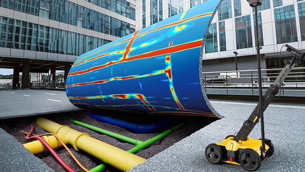
Subsurface Utility Mapping solution
Home
Subsurface Utility Mapping solution
Subsurface Utility Mapping solution