
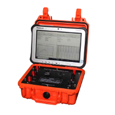
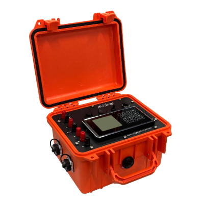
What is a Geo Electrical Resistivity Meter?
A Geo Electrical Resistivity Meter is a geophysical instrument used to measure the electrical resistivity of subsurface materials. Engineers introduce a controlled electrical current into the ground through electrodes and measure the resulting voltage response. The collected data helps identify variations in soil, rock, moisture, and geological formations. A Geo Electrical Resistivity Meter is commonly used for groundwater exploration, geological investigations, engineering surveys, and environmental studies.
What are the main features of a Geo Electrical Resistivity Meter?
Typical features include accurate current and voltage measurement, multiple electrode configurations, data storage, field-display capability, rechargeable battery operation, and software compatibility for data analysis. Advanced systems may support automatic electrode switching and electrical resistivity tomography (ERT). The exact specifications vary by model, so users should compare measurement range, accuracy, electrode channels, maximum current, data capacity, and software functions before purchasing.
Where is a Geo Electrical Resistivity Meter used?
A Geo Electrical Resistivity Meter is widely used for groundwater exploration, geological mapping, soil and rock investigation, environmental surveys, mineral exploration, foundation studies, and civil engineering projects. It can help identify subsurface boundaries, fractures, cavities, saturated zones, and changes in geological materials. The instrument is particularly valuable where engineers need non-destructive information about underground conditions before drilling or construction.
How does an electrical resistivity meter help in groundwater exploration?
Groundwater exploration commonly relies on differences in the electrical resistivity of subsurface materials. Water-bearing formations can produce different resistivity responses from dry soil, compact rock, clay, or fractured formations. By collecting measurements at multiple locations or depths, engineers can interpret subsurface resistivity patterns and identify areas that may warrant further investigation. However, resistivity data should be interpreted alongside geological information and, where appropriate, borehole or drilling results.
What are the benefits of using a Geo Electrical Resistivity Meter?
The major benefit is the ability to investigate underground conditions without extensive excavation. Resistivity surveys can provide valuable information about soil layers, geological structures, moisture distribution, fractures, and potential groundwater zones. The method can reduce unnecessary drilling and improve preliminary site assessment. For engineers and geoscientists, reliable resistivity data can support better decisions during geological, environmental, groundwater, and civil engineering investigations.
Which industries use Geo Electrical Resistivity Meters?
These instruments are used across several sectors, including geotechnical engineering, groundwater exploration, environmental consulting, geological research, mining, construction, infrastructure development, agriculture, and academic research. Survey companies also use resistivity equipment for site characterization and subsurface mapping. In Bangladesh, the equipment can be particularly useful for groundwater studies, infrastructure projects, land investigation, and geological assessment.
What should I consider when buying a Geo Electrical Resistivity Meter in Bangladesh?
Before purchasing, consider the required survey depth, measurement accuracy, electrode configuration, number of channels, maximum current output, data storage, battery capacity, field durability, and data-processing software. Also verify whether the instrument supports the survey method you intend to use, such as vertical electrical sounding or ERT. Buyers should consider local technical support, warranty coverage, accessories, training, and availability of replacement components in addition to the instrument's specifications.
How can I ensure the quality and authenticity of a Geo Electrical Resistivity Meter?
Purchase from an established and technically capable supplier that can provide proper product documentation, model identification, specifications, warranty information, and after-sales support. Check the instrument's serial number, calibration documentation where applicable, supplied accessories, and manufacturer information. A trustworthy supplier should also be able to explain the equipment's technical limitations and recommend a suitable configuration based on the intended survey rather than simply selling the highest-specification instrument.
Is a Geo Electrical Resistivity Meter covered by warranty?
Warranty coverage depends on the manufacturer, model, supplier, and purchase terms. Before ordering, confirm the warranty duration, covered components, exclusions, service procedure, and whether technical assistance is available locally. Buyers should retain the invoice, serial number, warranty documents, and product records. For professional geophysical equipment, clear warranty and after-sales arrangements are important because proper servicing can directly affect long-term measurement reliability.
Do suppliers provide technical support and how can I order?
A professional supplier should be able to assist with instrument selection, electrode configuration, basic operation, survey setup, data interpretation workflow, and troubleshooting. When ordering a Geo Electrical Resistivity Meter in Bangladesh, provide your application, expected survey depth, terrain conditions, required survey method, and project requirements. The supplier can then recommend a suitable configuration and confirm availability, accessories, warranty, delivery arrangements, installation or training options, and other purchasing requirements.