
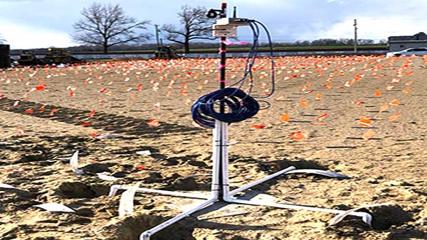
Ground Monitoring Survey in Bangladesh
Modern construction and infrastructure projects require reliable information about how the ground behaves before, during, and after development. Ground Monitoring Survey in Bangladesh provides engineers, contractors, developers, and project managers with valuable data about ground movement, settlement, deformation, excavation stability, and changes around construction sites. The service helps identify potential risks at an early stage and supports better engineering decisions. By observing ground conditions over time, professionals can understand whether soil and surrounding structures are behaving as expected. A properly planned ground monitoring program can be applied to buildings, bridges, roads, tunnels, retaining structures, industrial facilities, foundations, and other major projects. Accurate monitoring also helps improve construction safety, protect nearby properties, and maintain project performance throughout different construction stages.
Importance of Ground Monitoring for Construction Projects
Ground conditions can change because of excavation, loading, groundwater movement, vibration, foundation work, nearby construction, or changes in environmental conditions. These changes may not always be visible during routine site inspections. Ground monitoring provides a systematic approach for detecting such changes and documenting their development over time. Engineers can use monitoring information to compare actual ground behavior with expected design conditions. This allows project teams to respond when unusual movement or deformation is identified. Continuous observation is particularly useful for projects located in densely developed areas where nearby buildings, roads, utilities, and other structures may be affected by construction activities. Ground monitoring also supports risk management by providing objective technical information instead of relying only on visual observations or assumptions.
Ground Movement Monitoring and Deformation Assessment
Ground movement monitoring focuses on identifying changes in the position or condition of the ground surface and subsurface environment. Movement can occur vertically through settlement or heave and horizontally through lateral displacement. The extent and direction of movement can provide important information about soil response and construction influence. Survey professionals establish suitable monitoring points and record their positions at selected intervals. The collected observations are then compared with previous measurements to identify trends. Ground deformation monitoring can be especially valuable around deep excavations, retaining walls, embankments, foundations, and infrastructure corridors. Early identification of unexpected movement allows engineers to investigate possible causes and consider appropriate corrective measures before the situation becomes more serious.
Settlement Monitoring for Buildings and Structures
Settlement is an important consideration in construction because uneven ground movement can affect foundations and structural components. Settlement monitoring helps determine whether a building, foundation, pavement, or other structure is moving vertically over time. Monitoring points can be established at suitable locations and observed repeatedly throughout the project. The resulting data helps engineers understand the rate and pattern of settlement. Uniform movement may have a different engineering implication from differential movement between different parts of a structure. Regular monitoring can therefore support structural assessment and construction control. For large developments, settlement information can also be compared with design expectations and site investigation findings. This creates a stronger basis for evaluating foundation performance and identifying areas that may require additional attention.
Excavation Monitoring and Safety Control
Deep excavation can significantly influence surrounding soil and structures. Removing soil changes the stress condition of the ground and may lead to lateral movement, settlement, or changes around excavation boundaries. Ground Monitoring Survey in Bangladesh can help construction teams observe these changes during excavation activities. Monitoring points may be established around excavation areas, retaining systems, nearby structures, roads, and other sensitive locations. Regular observations provide information about whether movement remains within expected conditions. If monitoring indicates an unusual trend, engineers can investigate the possible cause and review the construction sequence or support system. This approach improves control over excavation-related risks and helps maintain safer working conditions. Monitoring is particularly valuable when excavation takes place close to existing buildings or important infrastructure.
Monitoring Retaining Walls and Supporting Structures
Retaining walls are designed to resist soil pressure and maintain ground at different elevations. Their performance can be influenced by soil conditions, drainage, loading, excavation activities, and construction sequence. Monitoring retaining structures helps identify displacement, rotation, settlement, or other changes that may affect performance. Survey observations can be used alongside engineering inspections and other instrumentation where required. Regular monitoring creates a record of structural behavior and allows project teams to identify developing trends. This information can be useful during both construction and long term operation. For sites with complex ground conditions, a monitoring program can provide additional confidence that retaining systems are performing according to engineering expectations. It also helps document site behavior for technical reporting and project records.
Ground Monitoring for Infrastructure Development
Roads, bridges, railways, tunnels, utility corridors, and other infrastructure projects can experience ground movement during construction and operation. Ground monitoring helps project teams understand how construction activities influence surrounding soil and infrastructure. Monitoring can be used along alignment corridors, near bridge foundations, around tunnel approaches, and in areas where existing facilities may be sensitive to movement. Data collected from monitoring points can help identify settlement, lateral displacement, or changes in ground profile. Infrastructure projects often extend across large areas, making systematic monitoring important for maintaining consistency and traceability. Reliable survey records also support communication between contractors, consultants, engineers, and project owners. By maintaining a clear monitoring history, project teams can make better informed decisions throughout the project lifecycle.
Survey Techniques Used in Ground Monitoring
Ground monitoring may involve different surveying techniques depending on project requirements, site conditions, accuracy expectations, and monitoring objectives. Conventional land surveying methods can be used to establish reference points and measure changes in position and elevation. Total stations can support precise monitoring of selected points, while digital levels may be used for detailed settlement observations. GNSS technology can provide positioning information where suitable reference conditions are available. For larger or more complex projects, automated monitoring systems may provide frequent observations and help identify changes more quickly. Remote sensing and other specialized techniques can also support specific monitoring requirements. The appropriate method is selected after considering the site environment, required accuracy, monitoring frequency, accessibility, and engineering purpo se.
Ground Monitoring Instruments and Equipment
Reliable equipment plays an important role in obtaining useful monitoring results. Survey teams may use total stations, digital levels, GNSS receivers, prisms, reflectors, monitoring targets, and other specialized instruments. The equipment selection depends on the type of movement being measured and the conditions of the project site. Instruments must be properly configured, checked, and maintained to support consistent measurements. Reference points also require careful selection because unstable reference locations can affect the quality of monitoring results. Experienced survey professionals understand the importance of instrument setup, observation procedures, environmental conditions, and data verification. Combining suitable equipment with a carefully designed monitoring methodology helps produce dependable information for engineering assessment and construction management.
Baseline Survey and Monitoring Reference Points
A reliable ground monitoring program normally begins with a baseline survey. The baseline establishes the initial condition against which future observations can be compared. Reference points and monitoring points are selected according to the site layout and project objectives. Stable reference locations are particularly important because all subsequent measurements depend on them. Monitoring points should be positioned where meaningful movement can be detected without interfering with construction activities. The baseline survey should be properly documented so that future observations can be evaluated consistently. Any changes in monitoring locations, site conditions, or reference points should also be recorded. A well prepared baseline provides a strong foundation for the entire monitoring program and improves the reliability of trend analysis.
Monitoring Data Collection and Analysis
Collecting measurements is only one part of a successful ground monitoring program. The recorded information must also be organized, checked, compared, and interpreted properly. Survey data can be evaluated against previous observations to identify changes in elevation, horizontal position, or other monitored parameters. Engineers may examine trends to determine whether movement is stable, increasing, decreasing, or occurring irregularly. Data quality checks are important because measurement errors, disturbed points, environmental conditions, or equipment issues can affect results. Proper analysis helps separate genuine ground movement from possible observation errors. Clear records also make it easier for engineers and project managers to understand site behavior. Well managed monitoring data can become an important technical resource throughout the construction process.
Ground Monitoring Reports for Engineering Decisions
Ground monitoring reports present survey findings in a structured and understandable format. A useful report may include monitoring locations, observation dates, measured changes, graphical trends, site photographs, survey information, and relevant technical comments. The reporting format should match the requirements of the project and the needs of the engineering team. Clear reports allow decision makers to quickly understand whether monitored conditions remain within expected behavior. When unusual movement is detected, the report can provide supporting information for further investigation. Consistent reporting also creates a documented history of ground conditions. This can be useful for construction records, technical reviews, client communication, safety management, and future reference. Accurate reporting therefore adds significant value to the monitoring process.
Applications in Urban Construction Projects
Urban construction sites often have limited space and are surrounded by existing buildings, roads, utility lines, and other infrastructure. Ground movement caused by excavation, foundation construction, dewatering, or heavy loading may affect neighboring properties. Ground monitoring provides a practical way to observe potential changes around the project area. Monitoring points can be established on suitable ground locations or nearby structures where appropriate. Regular observations can help project teams identify whether surrounding areas are experiencing unexpected movement. This information supports proactive construction management and communication with stakeholders. Urban projects can particularly benefit from a well structured monitoring plan because even relatively small changes may become important when construction takes place close to sensitive structures or public infrastructure.
Benefits of Professional Ground Monitoring Services
Professional ground monitoring offers several benefits for construction and infrastructure projects. It provides measurable information about ground behavior, supports early identification of unusual movement, and improves communication between project stakeholders. Monitoring can also support safer excavation, better construction planning, and more informed engineering decisions. A professional survey team can select appropriate monitoring locations, establish reliable reference systems, maintain consistent observation procedures, and prepare useful technical reports. Regular monitoring also creates a documented record that can help project teams understand how ground conditions change throughout construction. When combined with geotechnical investigation and structural assessment, monitoring data provides a broader understanding of site behavior. This integrated approach can help reduce uncertainty and improve confidence in project performance.
Selecting a Ground Monitoring Survey Provider in Bangladesh
Choosing an experienced service provider is important when ground monitoring data will influence engineering decisions. A suitable provider should have knowledge of land surveying, construction monitoring, measurement procedures, data processing, and technical reporting. The provider should also understand the specific requirements of the project and be able to recommend suitable monitoring techniques. Equipment capability, field experience, quality control procedures, and reporting practices should be considered during selection. Good communication is equally important because monitoring requirements may change as construction progresses. For complex projects, coordination between surveyors, geotechnical engineers, structural engineers, contractors, and consultants is essential. A professional Ground Monitoring Survey in Bangladesh should therefore focus not only on collecting measurements but also on delivering reliable information that can support practical engineering decisions.
Why Ground Monitoring Supports Safer Construction
Construction projects involve many variables, and ground behavior can sometimes differ from initial expectations. Ground monitoring provides an additional layer of control by showing how the site responds to construction activities over time. Instead of waiting for visible signs of damage or instability, project teams can use monitoring information to identify developing trends earlier. This supports proactive risk management and allows engineers to investigate unusual conditions before they potentially become more significant. Ground monitoring does not replace proper design, geotechnical investigation, structural assessment, or construction supervision. Instead, it complements these activities by providing real site data. For projects where ground movement is a concern, a carefully designed monitoring program can contribute significantly to safer construction, better project control, and long term infrastructure reliability.