

Topographic Survey in Bangladesh for Accurate Land Mapping
Land surveying provides the foundation for reliable planning, and Topographic Survey in Bangladesh delivers detailed information about ground levels, terrain, natural features, and existing structures. A topographic survey helps engineers, architects, developers, and project managers understand the physical condition of a site before design or construction begins. The survey records changes in elevation, slopes, roads, drainage channels, buildings, trees, utilities, water bodies, and other relevant features. This information creates an accurate representation of existing site conditions. Surveyors use modern instruments and suitable field techniques to collect dependable measurements and prepare clear drawings or digital data. The results can support site planning, infrastructure design, grading, drainage development, earthwork estimation, and construction activities. A properly conducted survey also reduces uncertainty during project execution because design teams can work from verified field information. Whether the project involves land development, road construction, buildings, industrial facilities, or infrastructure, accurate topographic data helps improve technical decisions and supports efficient project implementation.
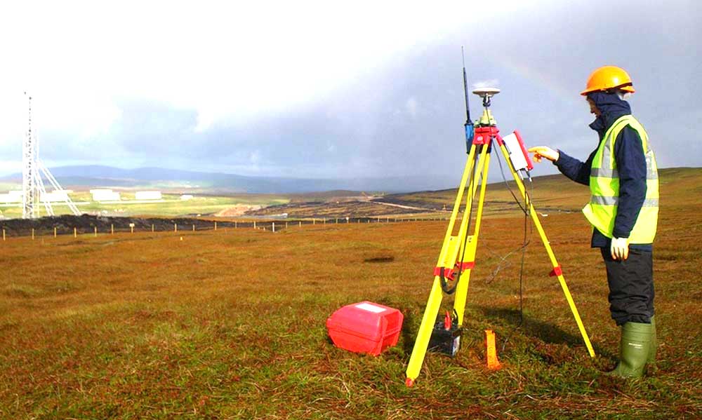
Importance of Topographic Land Survey
A topographic land survey is important because every construction site has its own physical characteristics. Even apparently level land may contain small elevation changes that can influence drainage, foundation levels, road alignment, and earthwork requirements. Surveyors collect ground elevation points and identify important surface features to create a reliable site model. Engineers can then use this information to understand slopes, low areas, high points, and natural drainage patterns. Accurate topographic information also helps reduce design changes caused by incorrect assumptions about existing conditions. It provides a common technical reference for architects, structural engineers, civil engineers, landscape designers, and contractors. For land development, the survey can help determine suitable locations for buildings, roads, utilities, drainage systems, and other facilities. It is also useful when evaluating an existing property before redevelopment or expansion. A detailed survey therefore supports both initial feasibility studies and later design stages. By establishing actual site conditions, topographic surveying improves communication among project participants and provides dependable information for engineering analysis and construction planning.
Topographic Survey for Construction Projects
Construction projects depend heavily on accurate information about existing ground conditions. A topographic survey provides the spatial and elevation data required to prepare a practical construction plan. Before excavation, filling, grading, road formation, or foundation work begins, engineers need to understand the existing terrain. Survey information can be used to establish design levels and compare proposed elevations with actual ground levels. This helps construction teams plan excavation and filling operations more effectively. The survey also identifies existing structures, access routes, drainage features, utility indicators, and other site constraints that may influence construction. During project development, survey data can be transferred into engineering drawings and digital terrain models for further analysis. Accurate information reduces the possibility of unexpected ground conditions affecting the project. It can also support site layout and construction control after the design has been completed. For large developments, reliable topographic data is particularly valuable because small errors in elevation or alignment can become significant across a wide area. Professional surveying therefore contributes to better coordination, improved site preparation, and more controlled construction activities.
Contour Survey and Elevation Mapping
Contour surveying is a key part of many topographic surveys because it represents changes in ground elevation across a site. Contour lines connect points having similar elevations and provide engineers with a visual understanding of terrain shape. Closely spaced contours generally indicate steeper ground, while wider spacing suggests gentler slopes. This information is useful for road design, drainage planning, grading, landscaping, and site development. Elevation mapping can also help identify natural depressions, ridges, embankments, and drainage paths. Surveyors collect elevation data at suitable locations based on the size, terrain, and purpose of the project. The collected measurements are processed to produce a contour plan or digital terrain representation. The required level of detail depends on the design requirements and site complexity. Accurate elevation data is especially important where surface water movement must be controlled. Engineers can use the survey to evaluate existing drainage patterns and develop suitable grading proposals. A well prepared contour survey gives design teams a clearer understanding of the land and helps them develop solutions that respond to actual terrain instead of relying on generalized maps or visual assumptions.
Land Features and Existing Structure Survey
A complete topographic survey records more than ground elevation. It also identifies physical features that may affect design, construction, access, and future land use. These features can include existing buildings, boundary walls, roads, pathways, trees, poles, drainage structures, ponds, canals, embankments, fences, and visible utility installations. Recording these elements provides engineers with a detailed picture of the site before development begins. Existing structures are particularly important because they can influence proposed building locations, setbacks, access arrangements, and utility connections. Trees and vegetation may also require consideration during planning because they can affect grading and environmental design. Drainage channels and water bodies are important for flood management and site drainage studies. Surveyors normally locate features using appropriate coordinates and elevations so they can be incorporated into project drawings. The level of detail should be selected according to the project purpose. A residential development may require a different survey specification from a highway or industrial project. By documenting relevant existing features systematically, topographic surveying helps project teams identify constraints early and make more informed design decisions.
Modern Equipment for Topographic Survey
Modern surveying equipment improves the efficiency and reliability of field data collection. Survey professionals may use total stations, GNSS equipment, digital levels, data collectors, drones, and other suitable technologies depending on project requirements. A total station can measure angles and distances with high precision and is widely used for detailed site surveys. GNSS equipment can provide accurate positioning over larger areas where suitable satellite visibility and correction services are available. Digital levels are useful when precise elevation control is required. Drone based surveying can capture extensive site information efficiently and can support photogrammetric mapping where appropriate. The choice of equipment should always consider terrain, vegetation, site accessibility, required accuracy, project scale, and environmental conditions. Technology alone does not guarantee accurate results. Proper survey control, instrument calibration , field procedures, observation methods, and quality checks remain essential. Experienced surveyors select the most suitable combination of equipment and techniques for each site. Modern tools can reduce field time and improve data collection, while professional processing ensures that the final survey information remains consistent and useful for engineering and construction applications.
Digital Terrain Model and Survey Data
A digital terrain model provides a computer based representation of the ground surface using surveyed elevation and location data. It allows engineers and designers to examine terrain conditions in greater detail than a conventional two dimensional drawing alone. Survey points, breaklines, contours, and other relevant information can be processed into a digital model that represents changes in ground level. This model can support grading design, drainage analysis, road alignment, earthwork studies, and site development planning. Digital survey data can also be integrated with computer aided design and other engineering software. This improves coordination between survey information and proposed design elements. A digital terrain model is particularly useful for larger projects where terrain varies considerably across the site. It can help identify high and low areas and provide a better basis for comparing existing and proposed ground levels. The quality of the model depends on the quality and distribution of field measurements. Surveyors must therefore collect sufficient data to represent important terrain changes and structural features. Properly prepared digital survey information provides a flexible technical resource that can remain useful throughout different stages of a development project.
Topographic Survey for Road and Infrastructure Design
Roads, bridges, drainage systems, utility corridors, and other infrastructure require detailed knowledge of existing terrain. A topographic survey provides the information needed to evaluate possible alignments and understand how infrastructure will interact with the land. For road projects, elevation data helps engineers develop longitudinal profiles, cross sections, drainage arrangements, and grading solutions. Existing roads, structures, canals, water bodies, and other obstacles can also be mapped during the survey. For drainage infrastructure, understanding the natural fall of the land is essential because water generally follows available gradients. Accurate topographic information helps engineers design drainage channels, culverts, retention areas, and related infrastructure according to actual site conditions. Utility projects also benefit from accurate mapping of visible features and surface indicators. Where underground utilities are involved, additional utility detection and verification may be necessary because a topographic survey does not automatically reveal concealed services. Infrastructure projects often cover large areas, making consistent survey control particularly important. Reliable topographic data supports alignment selection, design coordination, quantity assessment, and construction planning while reducing uncertainty associated with existing terrain.
Topographic Survey for Building Design
Building design should respond to the actual conditions of the site. A topographic survey gives architects and engineers information about ground elevations, slopes, access conditions, drainage, and nearby physical features. This information can influence the position and orientation of a proposed building. It can also help determine suitable entrance levels, finished floor levels, driveway connections, retaining requirements, and site grading. On sloping land, accurate elevation data is particularly important because the building may require stepped foundations, retaining structures, or carefully planned earthwork. A survey can also identify nearby roads and structures that may influence site access and development planning. When the survey is incorporated into the design drawings, architects and engineers can coordinate proposed elements with existing terrain more effectively. This reduces the risk of designing against incorrect site assumptions. A reliable topographic survey is therefore an important early input for residential, commercial, institutional, industrial, and mixed use developments. By providing verified field information, it helps design teams balance functional requirements with practical site conditions and develop solutions that are suitable for construction.
Topographic Survey for Drainage and Flood Planning
Drainage planning requires accurate elevation information because water movement is strongly influenced by ground slope and surface levels. A topographic survey helps engineers identify natural flow paths, depressions, drainage channels, embankments, ponds, and other features that influence surface water movement. This information is valuable when designing stormwater systems, site grading, culverts, retention facilities, and flood management measures. In areas affected by seasonal rainfall, poor drainage can create waterlogging and damage roads, buildings, and other infrastructure. Understanding existing terrain allows engineers to assess how proposed development may change runoff patterns. The survey can also provide useful information for hydraulic modelling when combined with appropriate hydrological and engineering data. However, topographic information should be considered alongside rainfall, soil, drainage capacity, water levels, and other relevant factors when conducting a complete flood study. Survey data provides the physical foundation for understanding the site's surface geometry. Accurate levels can also help establish suitable building and infrastructure elevations. A carefully prepared topographic survey therefore supports drainage solutions that are better aligned with actual ground conditions and site requirements.
Boundary and Property Development Survey
Topographic surveying can complement boundary surveying during property development, although the two services have different purposes. A boundary survey focuses on legal property limits, while a topographic survey focuses primarily on physical features and terrain. Combining relevant survey information can provide developers with a more complete understanding of a site. Existing fences, walls, roads, buildings, drainage features, and changes in elevation can be mapped alongside verified property boundaries where appropriate. This helps design teams understand where development can realistically occur. For subdivision and land development projects, accurate site information is important for planning roads, plots, open spaces, drainage systems, and utility corridors. Property development may also involve changes in ground level, requiring careful consideration of how grading affects adjacent land. Survey information can help identify potential conflicts before construction begins. Boundary matters should be established by qualified professionals using appropriate legal survey procedures, while topographic mapping should follow the technical requirements of the engineering project. When properly coordinated, these surveying services provide a reliable basis for site planning and help reduce uncertainty during development and construction.
Topographic Survey for Land Development
Land development projects often require detailed understanding of the existing terrain before planning begins. A topographic survey supports feasibility studies by showing how the land can accommodate proposed buildings, roads, drainage, utilities, landscaping, and other infrastructure. Survey data can reveal steep slopes, low lying areas, natural drainage routes, existing access conditions, and physical obstacles. This information helps planners compare development concep ts and identify potential engineering constraints at an early stage. It can also support preliminary grading strategies and site layout decisions. For large development areas, a digital terrain model can help visualize the relationship between existing terrain and proposed improvements. The survey may also be repeated or updated during different project phases when changes in site conditions need to be documented. Land development requires coordination between surveying, civil engineering, architecture, environmental planning, and construction management. Accurate field data provides a common reference for these disciplines. A professional topographic survey therefore contributes to more practical land use planning and helps developers and engineers understand the technical opportunities and limitations of a site before major construction activities begin.
Accuracy and Quality Control in Topographic Survey
Survey accuracy is fundamental to the usefulness of topographic information. Errors in field measurements, instrument setup, control points, data processing, or drafting can affect design decisions and construction work. Professional surveyors use established field procedures and quality control methods to reduce such errors. Survey control should be properly established and checked before detailed measurements are collected. Instruments should be maintained and calibrated according to appropriate procedures. Field observations should be reviewed for inconsistencies, and important measurements may require independent checks. Data processing should preserve coordinate systems, elevation references, units, and other project requirements correctly. The final drawing or digital model should be reviewed before delivery to ensure that important site features are represented accurately. Survey accuracy requirements vary depending on the purpose of the project. Detailed building work, infrastructure design, and general land mapping may have different technical specifications. It is therefore important to establish the required survey standard before fieldwork begins. Good quality control ensures that the final topographic survey is dependable and suitable for engineering design, construction planning, and future reference.
Professional Topographic Survey Services in Bangladesh
Professional topographic survey services in Bangladesh should combine appropriate technology, experienced surveyors, systematic fieldwork, and careful data processing. Local site conditions can vary considerably, from densely developed urban areas to open land, agricultural areas, coastal regions, and sites with complex drainage or vegetation. Survey methods should therefore be selected according to the specific physical and technical conditions of each project. A professional team begins by understanding the project requirements and determining the required survey coverage, coordinate reference, elevation control, feature collection, and final deliverables. Field data is then collected using suitable equipment and checked for consistency. The processed information may be presented as contour drawings, spot levels, plans, cross sections, digital terrain models, or other formats required by the project team. Clear documentation is important because engineers need to understand the reference system and survey limitations when using the data. Professional topographic surveying ultimately provides reliable site information for better planning, design, construction, and land development. Selecting an experienced surveying team helps ensure that the collected data is technically useful, clearly presented, and suitable for the intended engineering application.
Benefits of Topographic Survey for Engineering Projects
A reliable topographic survey offers significant benefits throughout the project lifecycle. It gives engineers an accurate understanding of existing terrain and helps them develop designs that respond to real site conditions. Early survey information can identify elevation differences, drainage constraints, access issues, existing structures, and other physical conditions that may influence the project. This can reduce design uncertainty and improve coordination between engineering disciplines. During construction, survey data can support site layout, grading, level control, and comparison between existing and proposed conditions. For project management, accurate site information can also improve planning and reduce the likelihood of unexpected field conflicts. The value of a topographic survey extends beyond the initial design stage because the collected information can remain useful for future maintenance, expansion, redevelopment, and site management. The most effective survey is one that matches the technical needs of the project and is supported by appropriate quality control. For construction and development in Bangladesh, professional topographic surveying provides a practical foundation for informed decisions, efficient design, controlled site preparation, and durable infrastructure development.